1. Chesapeake Bay, United States

Location: The eastern coast of the United States, spanning Maryland and Virginia.
Size: Approximately 200 miles in length and 30 miles at its widest point.
Chesapeake Bay, the largest estuary in the U.S., spans approximately 4,480 square miles and is renowned for its diverse ecosystem, supporting over 3,600 species of plants, fish, and animals. It holds significant historical landmarks like Jamestown and various Civil War sites. The bay’s economic importance is underscored by its support for fishing, tourism, and shipping industries, contributing over $33 billion annually.
Covering parts of six states and the District of Columbia, its watershed area is about 64,000 square miles, home to over 18 million people. The bay, approximately 200 miles long and 30 miles wide, contains around 15 trillion gallons of water. Historically, it produced 50% of the U.S.’s oysters and now provides about one-third of the nation’s blue crab catch.
Environmental efforts have reduced nitrogen pollution by over 25% since the 1980s, although the bay still experiences dead zones that can cover up to 40% in summer. Restoration projects are ongoing to enhance water quality, restore habitats, and ensure sustainable fisheries.
Many different kinds of animals, from bald eagles to blue crabs, call Chesapeake Bay, the biggest estuary in North America, their home. However, Chesapeake Bay faces ongoing challenges, including pollution and habitat loss. Conservation efforts are essential to protect this iconic estuary.
2. Hudson Bay, Canada

Location: Northern Canada, in the Arctic region.
Size: Approximately 1.2 million square kilometers make up Hudson Bay, making it the world’s second-largest bay.
Hudson Bay is the second-largest bay in the world. It covers about 470,000 square miles and is in the northeastern part of Canada. Quebec, Ontario, Manitoba, and Nunavut are all close by. The bay was named for the English traveler Henry Hudson, and it is important to history because it was used in the fur trade in the 17th and 18th centuries. It is home to many kinds of marine life, like beluga whales, seals, and many types of fish. It also has a big impact on the temperature of the area, making winters colder and summers cooler.
Covering about 1.4 million square miles of watershed area, the bay extends into parts of five Canadian provinces and territories. It has an average depth of 330 feet, with the deepest point reaching approximately 890 feet, and contains about 270,000 cubic miles of water. Hudson Bay is covered by ice from October to June and experiences a tidal range of up to 16.4 feet in some areas. During the summer months, it is home to over 50,000 beluga whales.
The region has a sparse population density, with few permanent settlements primarily consisting of Indigenous communities. Hudson Bay serves as an important route for maritime navigation, particularly for transporting minerals and other natural resources. However, environmental concerns such as climate change impacts, melting ice, and industrial pollution continue to affect the bay’s delicate ecosystem.
3. Bay of Bengal, India
Location: Stretching along the eastern coastline of India, Bangladesh, and Myanmar.
Size: The Bay of Bengal is the largest bay in the world, covering an area of approximately 2.17 million square kilometers.
The Bay of Bengal, the third largest bay in the world, spans approximately 839,000 square miles and is bordered by India, Bangladesh, Myanmar, and the Andaman and Nicobar Islands. Historically, it has served as a crucial trade route linking South and Southeast Asia with the Middle East and East Asia. The bay supports a rich biodiversity, including various species of fish, dolphins, whales, and sea turtles, and significantly influences the climate and weather patterns in the region, including the monsoon seasons.
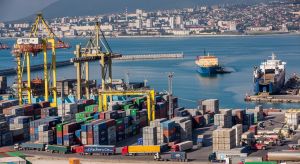
The bay’s deepest point, the Sunda Trench, reaches about 15,400 feet. Major rivers such as the Ganges, Brahmaputra, and Irrawaddy flow into the bay, which is surrounded by densely populated coastal regions with major cities like Kolkata, Chennai, and Dhaka. The Bay of Bengal is often hit by cyclones. Every year, a few big ones happen and cause a lot of damage and floods. The UNESCO World Heritage site Sundarbans is there. It is the world’s largest mangrove forest. Offshore oil and gas exploration, shipping routes, and the fishing business all depend on it.
The bay features several major ports, including the Port of Kolkata, Chennai Port, and Chittagong Port. However, it faces environmental concerns such as coastal erosion, pollution, and habitat destruction. Despite these challenges, the Bay of Bengal attracts tourists to its beautiful beaches, islands, and natural reserves, contributing to the local economies.
4. Amazon River Estuary, Brazil

Location: In South America, along the northeastern coast of Brazil.
Size: The Amazon River Estuary covers an immense area of approximately 2.7 million square kilometers.
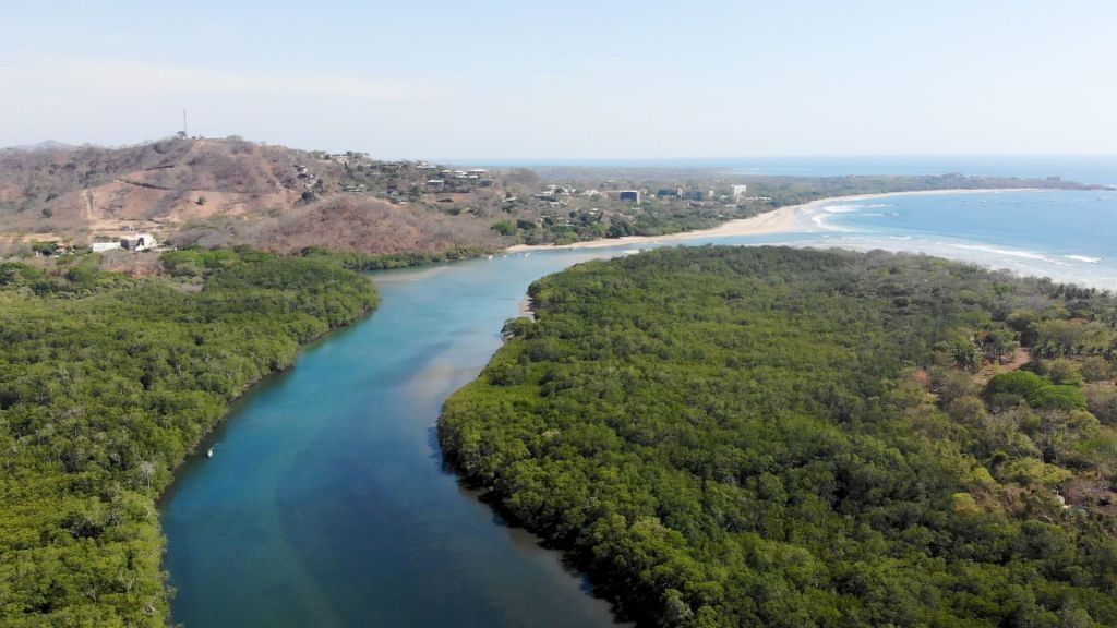
The Amazon River estuary, situated on the northeastern coast of Brazil where the Amazon River meets the Atlantic Ocean, has the largest discharge of any river in the world, contributing about one-fifth of the world’s total river discharge into oceans. This estuary is part of the vast Amazon Basin, the largest drainage basin globally, supporting an incredibly diverse array of wildlife, including numerous fish species, aquatic mammals, and birds.
About 209,000 cubic meters of water are dumped into the Atlantic Ocean every second by the Amazon River, which covers about 50,000 square miles. The channel covers about 50,000 square miles. The river carries and deposits about 1.3 million tons of sediment daily, and the mouth of the estuary can be as wide as 150 miles during the wet season. Major tributaries feeding into the estuary include the Negro, Madeira, and Tapajós rivers. Surrounding the estuary are extensive mangrove forests, providing crucial habitats for many species.
The region around the estuary is sparsely populated, with a few major cities such as Belém located nearby. Significant economic activities include fishing, transportation, and tourism. However, the estuary faces environmental concerns such as deforestation, pollution, and climate change, which pose threats to its delicate ecosystem.
5. Saint Lawrence River Estuary, Canada
Location: The Saint Lawrence River Estuary connects the Great Lakes to the Atlantic Ocean, flowing through eastern Canada.
Size: Covering an area of approximately 32,000 square kilometers, it is one of the largest estuaries in North America.
The Saint Lawrence River estuary is a vital waterway in North America, linking the Great Lakes to the Atlantic Ocean. It stretches from the eastern end of Lake Ontario in Canada, flowing northeast through Quebec to the Gulf of Saint Lawrence. The estuary supports a diverse range of marine and bird life, including beluga whales, seals, and various fish species.
The Saint Lawrence River, including the estuary, is about 744 miles long, with a drainage basin covering approximately 519,000 square miles. The estuary widens significantly, reaching up to 90 miles at its mouth, and discharges an average of 348,000 cubic feet of water per second. The estuary exhibits a gradual increase in salinity from freshwater to seawater along its length, and major ports along its banks include Montreal, Quebec City, and Trois-Rivières.
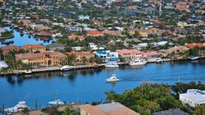
The region is densely populated, with numerous towns and cities along its banks. The estuary includes several protected areas and parks aimed at conserving its unique ecosystems. But it has to deal with environmental problems like pollution from factories, habitat loss, and the effects of climate change, all of which risk its delicate balance.
6. La Plata Estuary, Argentina and Uruguay

Location: Along the coasts of Argentina and Uruguay in South America.
Size: The La Plata Estuary is the largest estuary in South America, covering approximately 344,000 square kilometers.
The La Plata Estuary, one of the largest estuaries in South America, is situated between Argentina and Uruguay, where the Paraná and Uruguay rivers converge and flow into the Atlantic Ocean. The estuary is crucial for the economies of Argentina and Uruguay, supporting major ports like Buenos Aires and Montevideo. Wildlife from many different types, such as fish, marine mammals, and birds lives in the area.
The estuary spans about 13,500 square miles and is approximately 180 miles long. It widens from about 30 miles at its narrowest point to 136 miles at its widest point. The depth of the estuary varies, with some parts being relatively shallow, and it receives a large volume of freshwater from the Paraná and Uruguay rivers. Major ports along its shores include Buenos Aires in Argentina and Montevideo in Uruguay.
The estuary is densely populated along its shores, with major urban centers nearby, and serves as an important route for shipping and navigation. It exhibits a mix of freshwater and saltwater, creating a unique salinity gradient. However, the La Plata Estuary faces challenges such as pollution, habitat destruction, and the impacts of climate change, which threaten its ecological balance.
7. Nelson River Estuary, Canada

Location: Nestled in the remote Arctic wilderness of northern Canada.
Size: The exact size varies with the season, but it encompasses a substantial area.
The Nelson River estuary, a significant estuary in Canada, is located in northeastern Manitoba where the Nelson River flows into Hudson Bay. The river is crucial for hydroelectric power generation, with several major dams and power stations along its course. The estuary supports a variety of wildlife, including fish species, birds, and aquatic mammals, and influences the local climate and weather patterns in northern Manitoba.
The Nelson River is approximately 400 miles long, with a drainage basin covering about 444,000 square miles. It has a significant discharge, contributing large volumes of freshwater into Hudson Bay. Major tributaries include the Burntwood and Churchill rivers. The estuary area is home to several hydroelectric plants, including the Kettle, Long Spruce, and Limestone generating stations, and species such as beluga whales and various migratory birds.
The region is sparsely populated, with few permanent settlements, and the estuary serves as a route for transportation and resource extraction. Important economic activities include hydroelectric power, fishing, and limited agriculture. However, the Nelson River estuary faces environmental concerns such as habitat disruption due to hydroelectric development and the impacts of climate change.
8. Gulf of Khambhat, India

Location: The Gulf of Khambhat is situated along the western coast of India.
Size: Covering an area of approximately 22,000 square kilometers, it is one of India’s largest estuaries.
The Gulf of Khambhat, a major gulf on the west coast of India, is situated in the state of Gujarat, between the Kathiawar Peninsula and the mainland of Gujarat. Known for having one of the highest tidal ranges in the world, with tides reaching up to 35 feet, the gulf is crucial for India’s economy, supporting activities such as fishing, salt production, and shipping. The region is home to a variety of marine life, including fish, crustaceans, and bird species.
The Gulf of Khambhat is approximately 120 miles long and about 200 miles wide at its widest point. The depth of the gulf varies, with deeper channels facilitating navigation. Major ports in the region include the Port of Dahej and the Port of Bharuch, and major rivers such as the Narmada, Tapti, and Mahi flow into the gulf. The gulf is a significant area for salt production in India and a potential site for tidal energy projects due to its high tidal range.
The coastal regions around the gulf are densely populated, with several towns and cities, and the gulf supports extensive mangrove forests that provide crucial habitats for wildlife. Environmental problems, like pollution, habitat loss, and the effects of climate change, put the region’s fragile environments at risk.
9. Delaware Bay, United States

Location: Delaware Bay is located on the U.S. East Coast, bordered by Delaware and New Jersey.
Size: Covering approximately 1,700 square kilometers, it is a significant estuary along the Atlantic coast.
Delaware Bay, a significant estuary on the East Coast of the United States, is located between the states of Delaware and New Jersey. The bay supports major ports, commercial fishing, and shipping industries, and is home to diverse wildlife, including fish, crabs, oysters, and numerous bird species, particularly migratory birds. The bay contains extensive wetlands and marshes that provide critical habitats and serve as natural water filters.
Delaware Bay covers an area of approximately 782 square miles, is about 52 miles long, and ranges from 9 to 30 miles in width. The bay is about 30 feet deep on average, but there are deeper passageways for boats. The Delaware River and the Christina River are two of the most important rivers that flow into the bay. Key ports along the bay include the Port of Wilmington in Delaware and the Port of Philadelphia in Pennsylvania, and the bay is an important area for blue crab and oyster fisheries.
The bay experiences a moderate tidal range, influencing its ecology and navigation. The surrounding region is densely populated, with major cities and towns along its shores. But Delaware Bay has environmental problems like pollution, habitat loss, and the effects of climate change on its ecosystems. These problems threaten the bay’s economic and biological balance.
10. San Francisco Bay, United States
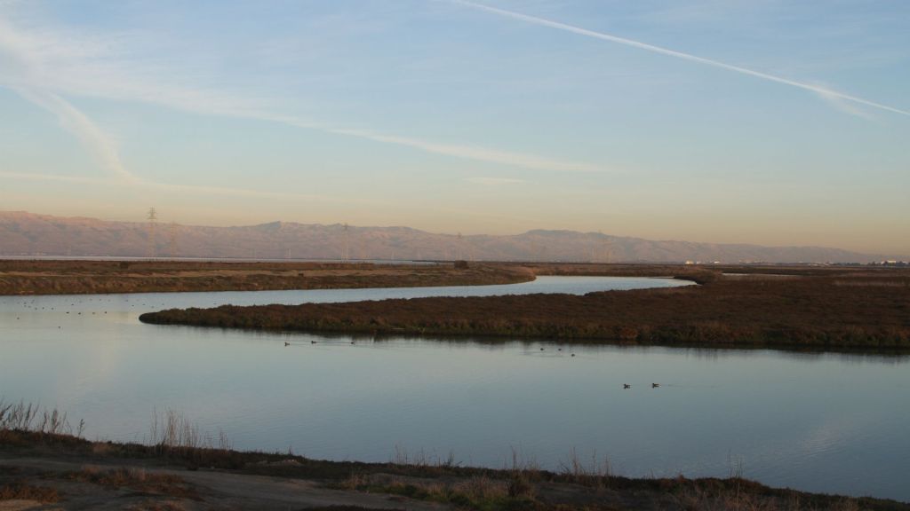
Location: Located in California’s San Francisco Bay Area, on the country’s western coast.
Size: Covering an area of approximately 1,600 square kilometers, it’s a unique urban estuary.
San Francisco Bay, a vital estuary on the West Coast of the United States, is situated in northern California and connects to the Pacific Ocean through the Golden Gate Strait. The bay area is a significant economic hub, hosting major ports, tech companies, and commercial activities. It supports a variety of marine and bird life, including fish, seals, and migratory birds, and includes important wetlands and tidal marshes that serve as habitats for numerous species and act as natural water filters.
The bay covers an area of approximately 1,600 square miles, is about 60 miles long, and ranges from 3 to 12 miles in width. The average depth of the bay is around 12 to 15 feet, with deeper channels for navigation. Major rivers flowing into the bay include the Sacramento River and the San Joaquin River. Notable bridges crossing the bay include the Golden Gate Bridge, the Bay Bridge, and the Richmond-San Rafael Bridge. Key ports include the Port of San Francisco, the Port of Oakland, and the Port of Richmond.
The surrounding region is densely populated, with major cities like San Francisco, Oakland, and San Jose. The bay is popular for recreational activities such as sailing, fishing, and bird watching. However, San Francisco Bay faces environmental concerns such as pollution, habitat loss, and the impacts of climate change on its ecosystems, which threaten its ecological balance and economic importance.
As we conclude our journey through the world’s largest estuaries, we’re reminded of their invaluable role in supporting life on our planet. These estuaries, which range in size and cover a wide range of geographical areas, demonstrate the astonishing variety of life on our planet. Conservation efforts are not just about protecting these natural wonders but also securing the future of countless species that depend on them. Estuaries continue to be vital meeting points where nature’s beauty and complexity shine through, making them an essential part of our world’s ecological tapestry.