In the vast tapestry of human innovation, few threads have been woven as intricately into our daily lives as the Global Positioning System (GPS). From the smartphones in our pockets to the satellites orbiting high above, GPS technology has revolutionized how we navigate, measure, and understand our world. At the heart of this technological marvel lies an ancient and cutting-edge practice: surveying. But not just any surveying—GPS surveying, a method that combines the timeless quest for precise measurement with the power of space-age technology.
The Dawn of a New Era
Picture this: It’s 1978, and a group of scientists and engineers are huddled around a computer terminal, their eyes fixed on a stream of data flowing in from a satellite high above the Earth. This moment marks the birth of the GPS era, a pivotal point in history that will forever change the landscape of surveying and mapping.
“We knew we were onto something big,” recalls Dr. Bradford Parkinson, often hailed as the father of GPS. “But I don’t think any of us could have predicted just how profoundly it would impact not just surveying, but nearly every aspect of modern life.”
Indeed, the impact has been nothing short of revolutionary. Traditional surveying methods, which had remained unchanged for centuries, were suddenly thrust into the space age. Gone were the days of painstakingly measuring angles and distances with theodolites and chains. In their place emerged a system that could pinpoint locations with millimeter-level accuracy, all with the help of signals beamed from space.
The Magic Behind the Technology
But how does it work? Imagine you’re standing in the middle of a vast, featureless plain. You have no landmarks, no compass, nothing but the sky above you. Now, picture four invisible lines stretching from your position to four different points in that sky. These points are GPS satellites, constantly broadcasting signals that contain information about their position and the time the signal was sent.
Your GPS receiver, whether a handheld device or a sophisticated surveying instrument, catches these signals. By measuring the time it takes for each signal to reach you, the receiver can calculate its distance from each satellite. With four satellites, it can determine your exact position on Earth—latitude, longitude, and even altitude.
GPS Technology and Surveying Statistics
“It’s like trilaterating your position in three-dimensional space,” explains Dr. Sarah Chen, a geodesist at the National Geodetic Survey. “Each satellite essentially asks, ‘How far are you from me?’ With enough of these distance measurements, we can pinpoint a location with incredible precision.”
A World Transformed
The implications of this technology for surveying have been staggering. Tasks that once took weeks can now be completed in hours. Accuracy that was once measured in meters is now measured in millimeters. However, the true power of GPS surveying lies not just in its precision but in its versatility.
Consider the case of the Millau Viaduct in southern France, which is the tallest bridge in the world. During its construction, GPS surveying was crucial in ensuring that the two sides of the bridge, built from opposite ends of a deep valley, would meet perfectly in the middle. The margin for error? Less than a centimeter.
“Without GPS, a project of this scale and precision would have been nearly impossible,” says Jean-Paul Teyssandier, one of the bridge’s chief engineers. “It allowed us to constantly monitor and adjust the position of each section as it was built, ensuring perfect alignment over a span of 2.46 kilometers.”
Beyond the Horizon: Diverse Applications
However, the applications of GPS surveying extend far beyond construction. Let’s explore some of the diverse fields where this technology is making a significant impact:
Geological Monitoring
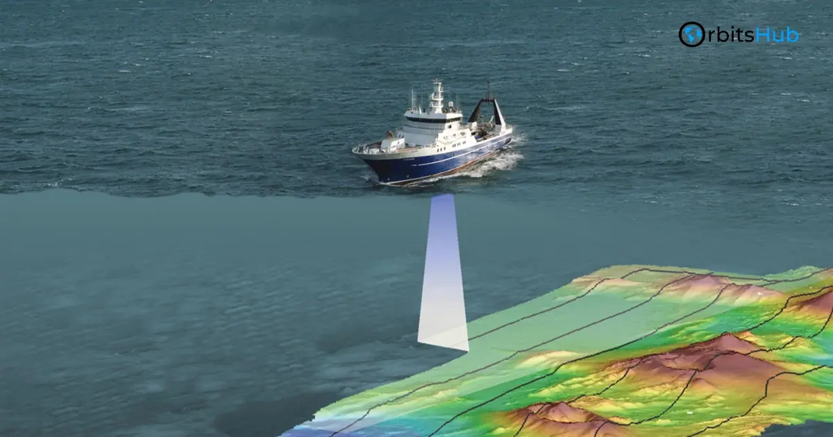
Geologists use GPS to monitor the slow dance of tectonic plates, tracking movements as small as a few millimeters per year. This precise measurement allows a better understanding of earthquake risks and geological processes.
Archaeological Discoveries
Archaeologists employ GPS surveying to map ancient sites with unprecedented detail, revealing hidden structures and patterns invisible to the naked eye. This technology has revolutionized the field, allowing for non-invasive exploration of historical sites.
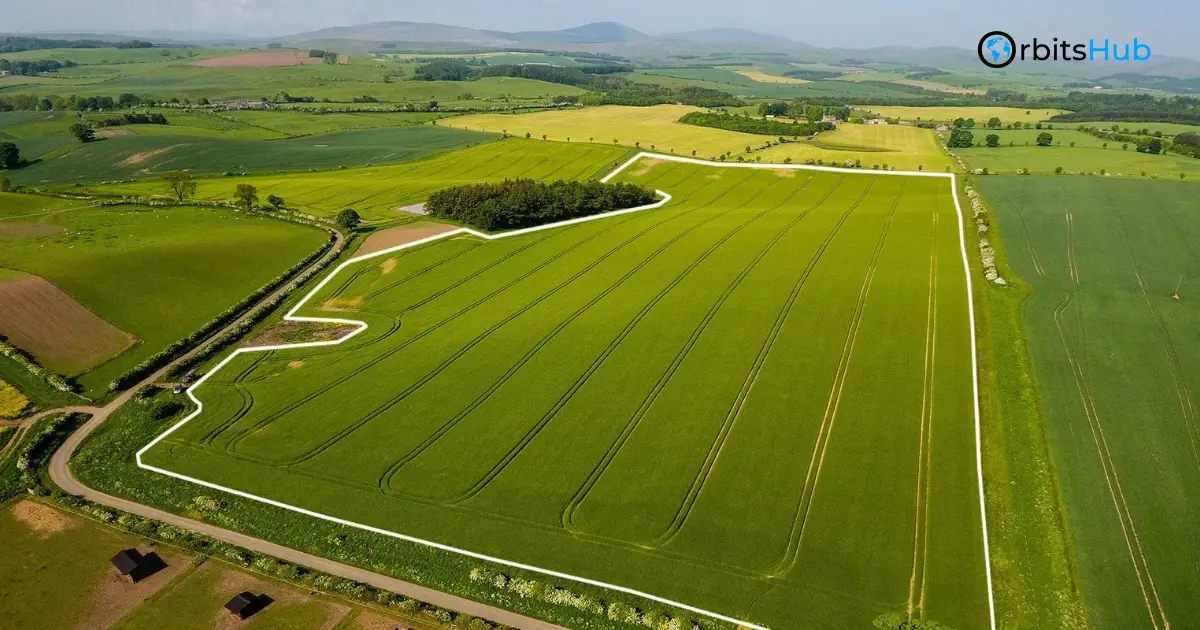
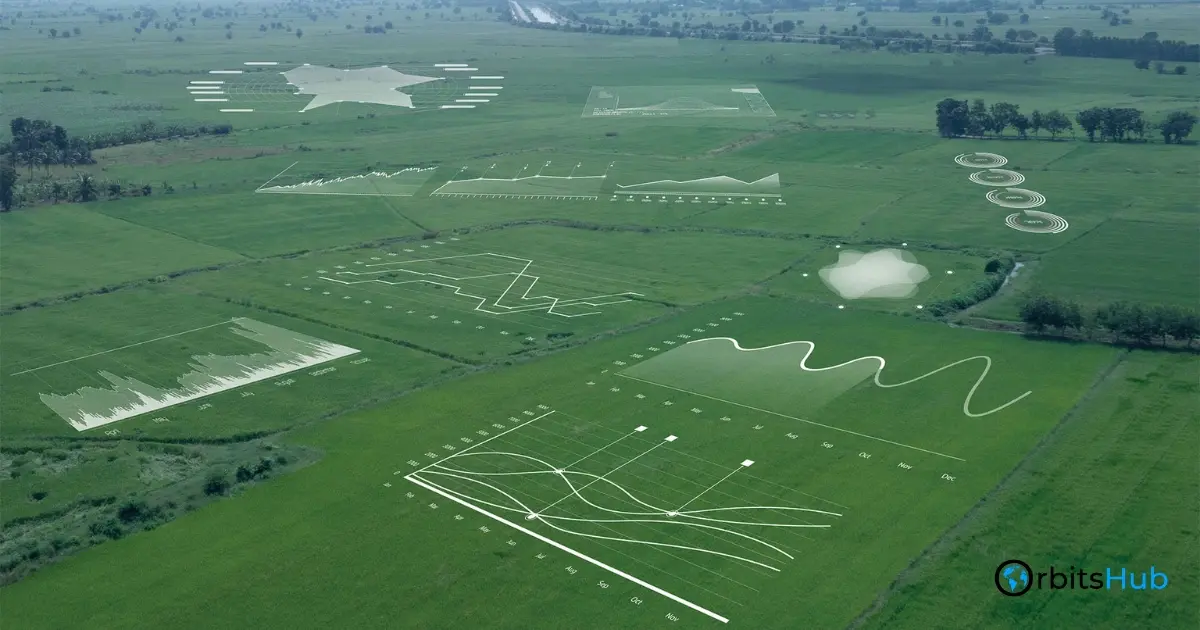
Precision Agriculture
In agriculture, GPS-guided tractors plow fields with centimeter-level precision, optimizing crop yields and reducing waste. This technology has ushered in an era of “smart farming,” where resources are used more efficiently than ever.
Urban Planning and Development
Urban planners use GPS surveys to create detailed 3D models of cities, aiding in everything from traffic management to disaster preparedness. These models help in making informed decisions about infrastructure development and city expansion.
Climate Change Research
Perhaps most crucially, GPS surveying is vital in understanding climate change. By precisely measuring changes in sea levels, ice sheet thickness, and land subsidence, scientists can track the effects of global warming with a level of detail that was once unimaginable.
“GPS surveying has become an indispensable tool in climate research,” notes Dr. Julienne Stroeve, a polar scientist at University College London. “It allows us to quantify changes in the Earth’s systems with a precision that was simply not possible before. This data is crucial for understanding the rate and impact of climate change.”
The Human Element: Surveyors in the Digital Age
Yet, for all its technological wizardry, GPS surveying remains a profoundly human endeavor. Behind every precise measurement and detailed map stands a surveyor—a modern-day explorer armed with cutting-edge technology and age-old wisdom.
Meet Maria Gonzalez, a GPS surveyor with over two decades of experience. “People think it’s all about the technology,” she laughs. “But there’s an art to it. You need to understand the land, the weather, and the local conditions. A good surveyor can read the landscape like a book.”
Maria’s work has taken her from the bustling streets of New York City to the remote wilderness of Alaska. “Every project is a new adventure,” she says. “One day you’re helping to lay out a new highway, the next you’re mapping glacial retreat in the Arctic. It’s a job that keeps you on your toes.”
The Numbers Speak: Economic Impact
The impact of GPS surveying on various industries is not just anecdotal—the numbers tell a compelling story:
- The global GPS equipment market is expected to reach $2.5 billion by 2028, growing at a CAGR of 9.2% from 2021 to 2028.
- In agriculture alone, GPS-guided precision farming techniques have increased crop yields by up to 10% while reducing water usage by 8%.
- The construction industry has seen productivity gains of up to 30% through GPS surveying and machine control systems.
- Geophysical surveys using GPS have improved the success rate of oil and gas exploration by 50%, significantly reducing the environmental impact of exploratory drilling.
These figures paint a picture of technology transforming industries and reshaping our relationship with the physical world.
Challenges and Controversies: Navigating the GPS Landscape
Yet, like any powerful technology, GPS surveying has controversies. Let’s examine some of the critical issues:
Privacy Concerns
Privacy concerns have been raised about the potential for misuse of precise location data. The ability to track individuals or assets with high precision has led to debates about personal privacy and data security.
Over-reliance on Technology
There are worries about over-reliance on technology, with some experts warning that we’re losing traditional surveying skills that could prove crucial in a significant GPS outage.
“We can’t forget the basics,” warns Dr. Robert Lee, a professor of geomatics at the University of New South Wales. “GPS is an incredible tool, but it’s not infallible. Solar flares, equipment malfunctions, and even intentional jamming can disrupt the system. We need to ensure we’re not putting all our eggs in one basket.”
The Digital Divide
There’s also the issue of the ‘digital divide’ in surveying. While developed countries reap the benefits of advanced GPS technology, many developing nations lack access to these tools, potentially widening global land management and infrastructure development inequalities.
The Road Ahead: Future of GPS Surveying

As we look to the future, the horizon for GPS surveying seems limitless. Several exciting developments are on the horizon:
Augmented Reality Integration
Emerging technologies like augmented reality are beginning to integrate with GPS, allowing surveyors to visualize complex 3D data in real time, overlaid on the physical world.
5G Network Enhancement
The advent of 5G networks promises to further enhance the precision and reliability of GPS measurements, enabling centimeter-level accuracy for consumer devices. This could open up a new world of applications, from self-driving cars to personalized, location-based health monitoring.
Next-Generation Satellites
Meanwhile, the next generation of GPS satellites, GPS III, is already being deployed. These advanced spacecraft offer improved accuracy, stronger signals, and better resistance to jamming, ensuring that the foundation of GPS surveying remains robust for decades to come.
“We’re just scratching the surface of what’s possible,” says Dr. Parkinson, reflecting on the technology he helped create nearly half a century ago.
“The fusion of GPS with other technologies—artificial intelligence, quantum sensors, the Internet of Things—will lead to applications we can barely imagine today.”
Environmental Applications: Safeguarding Our Planet
GPS surveying plays a crucial role in environmental monitoring and conservation efforts. From tracking wildlife migrations to mapping deforestation, this technology provides invaluable data for environmental scientists and policymakers. For instance, GPS-enabled drones are now used to monitor illegal logging in the Amazon rainforest, offering real-time insights that were previously impossible to obtain.
GPS Technology in Environmental Monitoring
Moreover, GPS surveying is instrumental in studying the effects of climate change. By precisely measuring glacial retreat, coastal erosion, and changes in vegetation patterns, researchers can quantify environmental changes with unprecedented accuracy. This data is vital for developing effective strategies to mitigate and adapt to the impacts of global warming.
Disaster Management and Emergency Response
In times of crisis, accurate geographical information can mean the difference between life and death. GPS surveying has revolutionized disaster management and emergency response efforts.
During natural disasters like earthquakes or hurricanes, GPS technology allows for rapid mapping of affected areas, helping first responders navigate damaged infrastructure and locate survivors more efficiently.
Moreover, GPS surveying creates detailed hazard maps that identify areas prone to flooding, landslides, or other natural disasters. This information is crucial for urban planning and developing early warning systems, ultimately saving lives and reducing property damage.
The Role of GPS in Smart Cities
As urban areas continue to grow and evolve, GPS surveying is becoming an integral part of the smart city concept. This technology enables precise mapping of city infrastructure, from underground utilities to transportation networks. Smart traffic management systems rely on GPS data to optimize traffic flow and reduce congestion, while city planners use GPS-derived 3D models to visualize and plan urban development projects.
GPS surveying also plays a key role in the implementation of location-based services within smart cities. From optimizing public transportation routes to managing waste collection, the accurate spatial data provided by GPS technology is helping cities become more efficient, sustainable, and livable for their residents.
These additional sections provide a broader perspective on the applications and impact of GPS surveying across various domains, enhancing the overall depth and scope of the article.
Mapping the Future
As we stand on the cusp of this new era, one thing is clear: the story of GPS surveying is far from over. It’s a tale of human ingenuity, of our endless quest to measure, map, and understand the world around us. The journey continues from the ancient surveyors of Egypt, who used plumb bobs and measuring ropes to chart the Nile, to the modern-day pioneers wielding satellites and atomic clocks.
Ultimately, GPS surveying is more than just a technology—it’s a testament to human curiosity and our drive to explore. It reminds us that even in this age of digital wonders, we can still find magic in knowing exactly where we stand on this vast, spinning globe we call home.
So, the next time you use your smartphone to navigate to a new restaurant or marvel at the precision of a newly constructed skyscraper, take a moment to appreciate the invisible web of signals and calculations that make it all possible.
At that moment, you’re not just using technology—you’re participating in one of humanity’s most incredible adventures: the ongoing quest to map, measure, and understand our world with ever-greater precision.
Frequently Asked Questions
A: GPS surveying can achieve millimeter-level accuracy over large areas, surpassing traditional methods in many applications.
A: Key challenges include privacy concerns, over-reliance on technology, and the ‘digital divide’ in access to advanced GPS tools between developed and developing nations