Table of Contents
Marine Radars: Everything You Need to Know- During World War II, the British military deployed radar for the first time in the early 1940s. This technique was employed to find hostile ships and planes. The United States Coast Guard created the first marine radar system in the 1950s. The tracking of storms and other meteorological phenomena was done using this technique. Marine radars have developed over time and are currently utilized for several tasks, including navigation, weather forecasting, and search and rescue operations.
Marine Radars: Everything You Need to Know
To find objects and their locations near where you are right now, utilize marine radar, also known as radio detection and ranging. It operates by broadcasting a radio signal. When a sign strikes an item, it is reflected on the radar, allowing it to determine the approximate size of the object. To provide heading and distance for collision avoidance and maritime navigation, it achieves this by identifying other ships and land impediments.
Boaters’ primary navigational assistance is a marine radar system. Even in low visibility, it helps to detect boats, birds, landmasses, and weather systems.
Top elements to keep in mind for marine radar
Beam angle and transmitter power are the two critical components of marine radar equipment. Power output can vary between 2 and 4 kilowatts. How well your radar functions in adverse weather is greatly influenced by power. Your transmitter’s ability to see through thick fog and rain improves with increasing radar power, as does the signal’s range. Low-power radar may not operate as effectively as it should due to blinding rain. The size of a radar antenna affects the beam angle. A longer antenna than a shorter one creates a narrower beam that may distinguish between things closer together. However, a short antenna results in a larger beam angle.
Alarm in a guard zone
Most marine radars allow you to create a guard zone around your boat. You may set the alarm for danger and a safe distance. The notice will go off if your boat discovers a buoy, a landmass, or another similar obstruction in the vicinity of your designated guard zone.
Split-screen presentations
The capability comes in handy, among other things, for navigating past buoys when you set off from the coast in search of a remote location. You may simultaneously control all of the items that are close to your boat and those that are farther away, thanks to split-screen displays.
Marine radar usage
The capacity of marine radar to establish where you are about where you were a few minutes ago is one of its finest characteristics. The “echo trail” function is frequently used to assess your ability to negotiate a barrier separately from your capacity to keep your vessel’s bearing. The radar’s display screen shows the echo trail, enabling visual evaluation of whatever is going on.
Integrated GPS and maritime radar
Marine radars are often very costly; several models cost hundreds of dollars. It is preferable to speak with local boaters to learn about their gear. Before spending so much money, ask them what features they enjoy. You may look for marine radars that include additional maritime gadgets like chart plotters and GPS systems. Integrating marine components reduces your visual displays’ complexity and decreases the goods’ overall cost. The capabilities included in an integrated package may occasionally need a trade-off, but such radars are worth the money for boaters who like sailing.
Use a maritime radar system to follow other vessels.
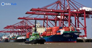
Keeping track of all objects in your path, like other boats and larger ships, comes in handy when you don’t want to compromise your safety on the water for anything, whether you are at sea on a chilly sailing vacation, engaged in a commercial fishing adventure hundreds of miles offshore, or you are transporting freight from one port to another. With the most recent marine radar systems from Garmin, Raymarine, and Simrad, you may take advantage of several technologies that make tracking other boats easier than ever. You may even indicate the places and courses of some radar domes and arrays on the screen.
The water may be unkind sometimes, and even a tiny deviation from the usual can occur almost fast. A thick fog may obscure the surrounding area as you sail through calm water one minute, and you may be battling with enormous waves and strong winds the next.
The fluid nature of water means that when conditions change, you may encounter various difficulties that might jeopardize your safety. Eliminating as many variables as possible from the big picture is the most excellent method to secure your safety. Radars are the greatest for this, too!
Any mariner can encounter severe hazards from other boats. While focusing on more considerable obstructions like massive cargo ships and cruise liners, sailors may miss smaller vessels travelling in the same direction. This small error might have devastating consequences. The sailor and crew must watch the radar data and the surrounding sea conditions.
Plotting the relative positions of other ships over time is one of the most outstanding features of modern marine radar systems from manufacturers like Furuno. You can see other vessels as a trail across the region rather than just as anonymous dots on the screen that don’t reveal anything. Since the motions are displayed, you may determine whether boats are a threat to yours and take appropriate action.
Your safety should come first while you’re at sea and can’t see land. So instead of putting your safety in the hands of others, keep yourself protected with a dependable, effective marine radar system.
You may easily make well-informed navigational judgments and avoid difficulty at sea once you understand how to read the information transmitted on your marine radar system. You may feel safe knowing what is approaching your vessel and what is going on beyond your line of sight. It enables you to respond swiftly to anything nearby, including weather systems, waves, oil tankers, and other events.
In addition to keeping an eye on what you are doing, it is crucial to know what other vessels are doing. Using a marine radar plotter, you may safeguard your position by monitoring. A navigational radar plotter can secure your ship and passengers even in the worst situations.
Related FAQs
What is a marine radar system, and how does it work?
- A marine radar system uses radio waves to locate objects and displays the information on a screen.
- The radar antenna sends out a beam that reflects back from objects, and the system analyzes the signal to determine distance, direction, and speed.